
I watched a floatplane take off from a lake in northern Minnesota a few summers ago. Just taxied across the water like a boat, lifted off, and disappeared over the tree line. My kid asked if that lake had an airport code. I said probably not. I was wrong. It did. That sent me down a rabbit hole about seaplane bases, water airports, and the surprisingly formal system that keeps track of them all.
Seaplane Bases Get Real Codes
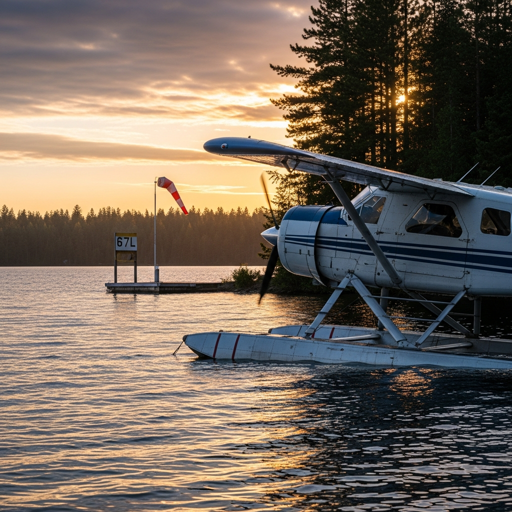
This surprised me more than it should have. Seaplane bases — official water landing areas for floatplanes and amphibious aircraft — receive legitimate airport codes from the FAA, just like land-based airports. They show up on aeronautical charts. Pilots file flight plans to them. They’re in the same national aviation database as O’Hare and LAX, just with a very different kind of runway.
The codes follow standard FAA conventions for the most part, though some include indicators that flag the facility as water-based. Floatplane pilots use specialized publications and charts that highlight these sites, because obviously you need to know whether your destination has a paved runway or a stretch of calm water. the aviation system doesn’t treat seaplane bases as second-class airports. They’re fully integrated into the infrastructure, codes and all.
Alaska Is Where Seaplane Coding Gets Wild
If you want to understand seaplane bases, you have to talk about Alaska. The state has more registered seaplanes than anywhere else on earth. Hundreds of seaplane bases serve communities you literally cannot reach by road. Groceries, mail, medical supplies — it all comes in by floatplane to lakes and rivers with official designations.
Lake Hood in Anchorage is the crown jewel. It’s the world’s largest and busiest seaplane base, and it sits right next to Ted Stevens Anchorage International. Watching a 737 land on the conventional runway while a bush plane splashes down on the lake fifty yards away is genuinely one of the coolest aviation things I’ve ever seen. The coding system up there has to cover countless water bodies, each with its own identifier so pilots can navigate Alaska’s backcountry without confusion.
Airports That Do Both
Some facilities operate as regular airports AND seaplane bases simultaneously, which means they need multiple codes or at least distinct identifiers for each surface. An amphibious aircraft — one with both floats and wheels — might take off from water at one facility and land on pavement at another. The pilot’s flight plan needs to reflect which surface they’re using at each end, and the codes make that possible.
That’s what makes these dual-use facilities notable. They represent the flexibility of amphibious aviation. Island communities, lakefront towns, coastal destinations — these places get served by aircraft that don’t care whether there’s a paved strip or a sheltered bay. As long as there’s a code in the system, it’s a legitimate destination.
Seaplane Operations Around the World
This isn’t just an American thing. The Maldives runs an extensive seaplane network connecting resort islands — it’s basically the public transit system there. British Columbia has major seaplane routes linking Vancouver to Victoria and the Gulf Islands. The Mediterranean, Scandinavia, the South Pacific — seaplanes operate everywhere there’s water and demand.
International seaplane bases follow ICAO coding conventions while adapting to local regulations, and the number of coded facilities keeps growing as seaplane tourism expands. New bases need new codes, and the system stretches to accommodate them. It’s a small corner of aviation infrastructure, sure, but it’s one of the most interesting ones if you ask me.


Stay in the loop
Get the latest airport pin updates delivered to your inbox.